Forests are critical to the health of our planet, playing a key role in carbon sequestration, biodiversity preservation, and the regulation of the water cycle.
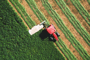
However, these ecosystems face numerous threats, including deforestation, disease, and the impacts of climate change. Traditionally, monitoring forest health required extensive fieldwork, which is both time-consuming and costly.
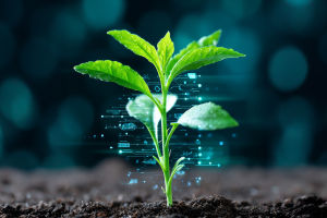
In recent years, remote sensing technology has emerged as a revolutionary tool, offering real-time, large-scale insights into forest conditions without the need for physical presence in the field.
This article explores the role of remote sensing in forest health monitoring, examining how it works, its applications, and its benefits. By leveraging satellites, drones, and other airborne technologies, remote sensing provides an efficient and accurate method to monitor forest ecosystems and implement timely interventions to protect them.
What is Remote Sensing?
Remote sensing involves the use of satellite, airborne, or ground-based sensors to collect data about objects or areas from a distance. In the context of forest monitoring, remote sensing tools capture images and data that provide detailed information about forest conditions, such as canopy cover, tree health, and biomass.
These sensors can detect a wide range of environmental factors, including:
1. Vegetation health: Detecting signs of stress or disease in plants.
2. Forest density: Assessing the number of trees in a given area.
3. Soil moisture levels: Identifying areas that may be vulnerable to drought.
4. Temperature and weather patterns: Monitoring changes in climate that could affect forest ecosystems.
The technology employs various types of sensors, such as optical, thermal, and LiDAR (Light Detection and Ranging), which can provide data on different aspects of forest health. Satellite imagery, in particular, offers the advantage of monitoring large areas that would otherwise be inaccessible or difficult to study.
How Remote Sensing is Used to Monitor Forest Health
Remote sensing allows for comprehensive monitoring of forests, tracking changes over time with high levels of accuracy. Here are some of the key ways it is applied in forest health assessments:
1. Detecting Deforestation and Land Use Changes: One of the most significant applications of remote sensing is its ability to detect and track deforestation. Satellite images can compare forest cover at different time intervals to assess how much forest has been cleared for agriculture, urban development, or logging. This can help conservationists and policymakers understand the rate of deforestation and implement targeted strategies to protect critical habitats.
2. Assessing Forest Biomass and Carbon Stocks: Forests act as carbon sinks, absorbing carbon dioxide and helping to mitigate the effects of climate change. Remote sensing is increasingly being used to estimate the biomass of forests—essentially, the amount of carbon stored in trees and other vegetation. Through the use of LiDAR and radar, scientists can estimate tree height, canopy density, and overall forest structure, providing valuable data to help manage carbon sequestration efforts.
3. Monitoring Forest Health and Stress: One of the most valuable aspects of remote sensing is its ability to detect early signs of forest stress or disease. Changes in the color of leaves, for example, can indicate nutrient deficiencies, pest infestations, or fungal infections. Remote sensing tools can monitor the chlorophyll levels in vegetation, which is an indicator of plant health. By identifying these stress factors early, forest managers can take proactive measures to prevent widespread damage.
4. Tracking Invasive Species: Invasive species can have a devastating impact on forest ecosystems by outcompeting native plants and disrupting the local food web. Remote sensing can help identify the presence and spread of invasive species by tracking changes in vegetation patterns. This allows for more targeted efforts to control or eliminate these species before they become too widespread.
5. Assessing the Impact of Wildfires: Wildfires are a major threat to forests, particularly in regions experiencing prolonged droughts or rising temperatures. Remote sensing allows for the rapid assessment of wildfire damage by capturing before-and-after imagery of affected areas. Additionally, it can be used to monitor fire behavior during an active fire, helping emergency responders deploy resources more effectively.
Benefits of Using Remote Sensing for Forest Health Monitoring
The integration of remote sensing into forest management offers numerous benefits that make it an invaluable tool for conservation efforts:
1. Cost-Effective: Traditional methods of forest health monitoring, such as field surveys, are labor-intensive and expensive. Remote sensing, on the other hand, allows for large-scale monitoring at a fraction of the cost, especially when satellites can capture images of entire regions in one go.
2. Timely and Efficient Data Collection: Remote sensing can provide near real-time data, which is crucial for monitoring rapidly changing conditions like forest fires or pest outbreaks. This enables quicker responses and more effective management strategies.
3. Accessibility of Hard-to-Reach Areas: Forests in remote or rugged locations can be difficult or impossible to access using traditional field methods. Satellites and drones, however, can reach these areas with ease, providing valuable data from locations that may be physically challenging for researchers.
4. Comprehensive Coverage: Remote sensing allows for the monitoring of vast areas in a short period. While a field survey might cover only a few acres a day, satellites can monitor thousands of square kilometers in the same amount of time. This makes remote sensing a powerful tool for monitoring global forest health and tracking long-term changes.
Challenges and Limitations of Remote Sensing in Forest Health Monitoring
While remote sensing offers immense benefits, it is not without its challenges:
1. Data Interpretation: While the data collected by remote sensors is valuable, it often requires expert analysis to be fully understood. Interpretation of satellite images, for example, can be complex and time-consuming, requiring specialized knowledge and software.
2. Cloud Cover and Weather Interference: Cloud cover can obscure satellite images, especially in tropical regions where rainfall is common. While there are advanced technologies to minimize these limitations, frequent cloud cover can make it difficult to gather consistent data.
3. High Initial Costs: Although remote sensing can be cost-effective over time, the initial setup and investment in technology can be significant. Satellite imagery, for instance, often requires high-quality sensors and software, which may not be affordable for all forest management programs.
The Future of Remote Sensing in Forest Management
The future of remote sensing in forest health monitoring looks bright, with continued advancements in technology making the process more efficient and effective. The integration of artificial intelligence (AI) and machine learning is expected to further enhance the analysis of remote sensing data, automating tasks such as vegetation classification and forest stress detection.
Additionally, the increased use of drone technology will provide even more granular data, especially for smaller forest plots that might not be covered by satellite imagery. Drones can capture high-resolution images and provide data on forest conditions at a much finer scale, which can be invaluable for local forest management.
Conclusion: A Key Tool for Forest Conservation
Remote sensing has transformed how we monitor and manage forest health. By providing accurate, large-scale data on forest conditions, it allows for more effective conservation and management strategies, enabling faster responses to threats like disease, deforestation, and climate change. As technology continues to advance, remote sensing will undoubtedly play an even more critical role in the protection of our planet's forests and their invaluable ecosystems.